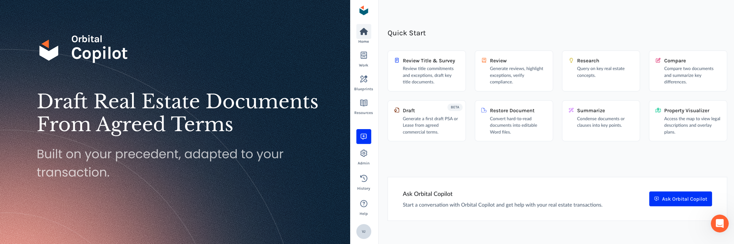
Property Visualizer: Understanding the Property Behind the Paperwork

Orbital
Orbital

Real estate law is intensely document-driven. Reviewing this paperwork is essential: it defines what can be owned, financed, or built. A single overlooked clause or boundary line can cloud ownership, derail financing, or expose clients to costly disputes.
The challenge is that every document describes a physical asset, and the words on the page do not always match the reality on the ground. Whether advising on an acquisition, reviewing restrictions for a development, or helping resolve a boundary dispute, real estate attorneys need to translate dense text into a clear understanding of the property.
Until now, real estate professionals have had to patch things together by hand or rely on outdated software not designed for legal work. Property Visualizer, part of Orbital Copilot, fills that gap for real estate attorneys in the US.
The Old Way: Slow and Fragmented
Real estate attorneys need to know where the property is, what it looks like, and what surrounds it. But even basic questions like “Which parcel are we dealing with?” or “Does this easement cut through the site?” can take hours to answer.
• Hunt for parcels: At the outset, you may only have a PSA, deed, or parcel number. Rural tracts often have no address, so attorneys toggle between Google Maps and assessor sites with patchy coverage.
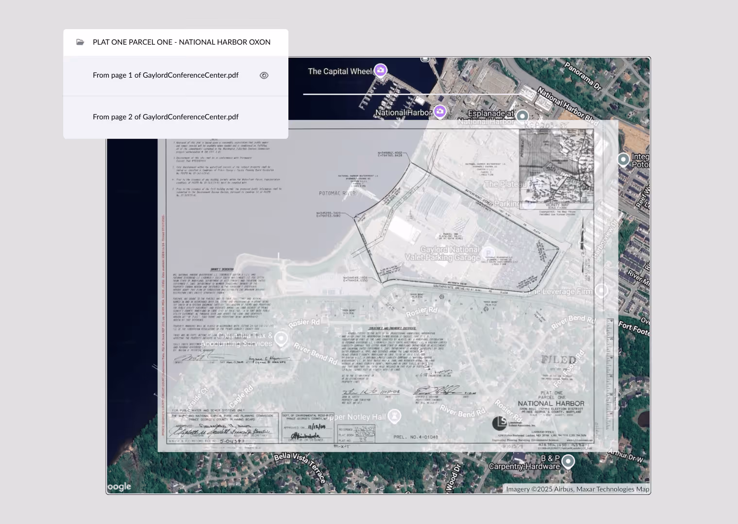
• Manually plot descriptions: Legal descriptions, boundaries, and exceptions must be reconciled across commitments, deeds, and surveys. Many still plot them manually or use outdated tools that only produce crude outlines.
• Line up documents by hand: To verify boundaries and easements, attorneys often print, trace, and manually line up documents against maps or aerials.
The New Way: Automated and Consolidated
Property Visualizer brings together legal descriptions, parcel data, surveys, and maps in one place. It helps real estate attorneys and title professionals:
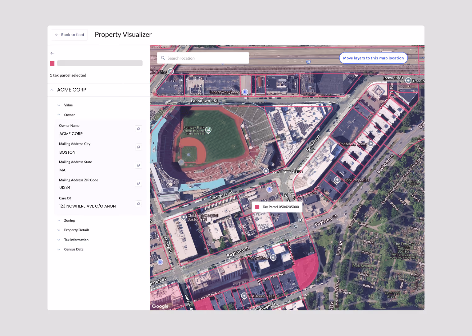
✓ Quickly locate a site: Eliminate delays at the outset by searching by address or parcel number and confirming the correct parcel, boundaries, and ownership with tax data.
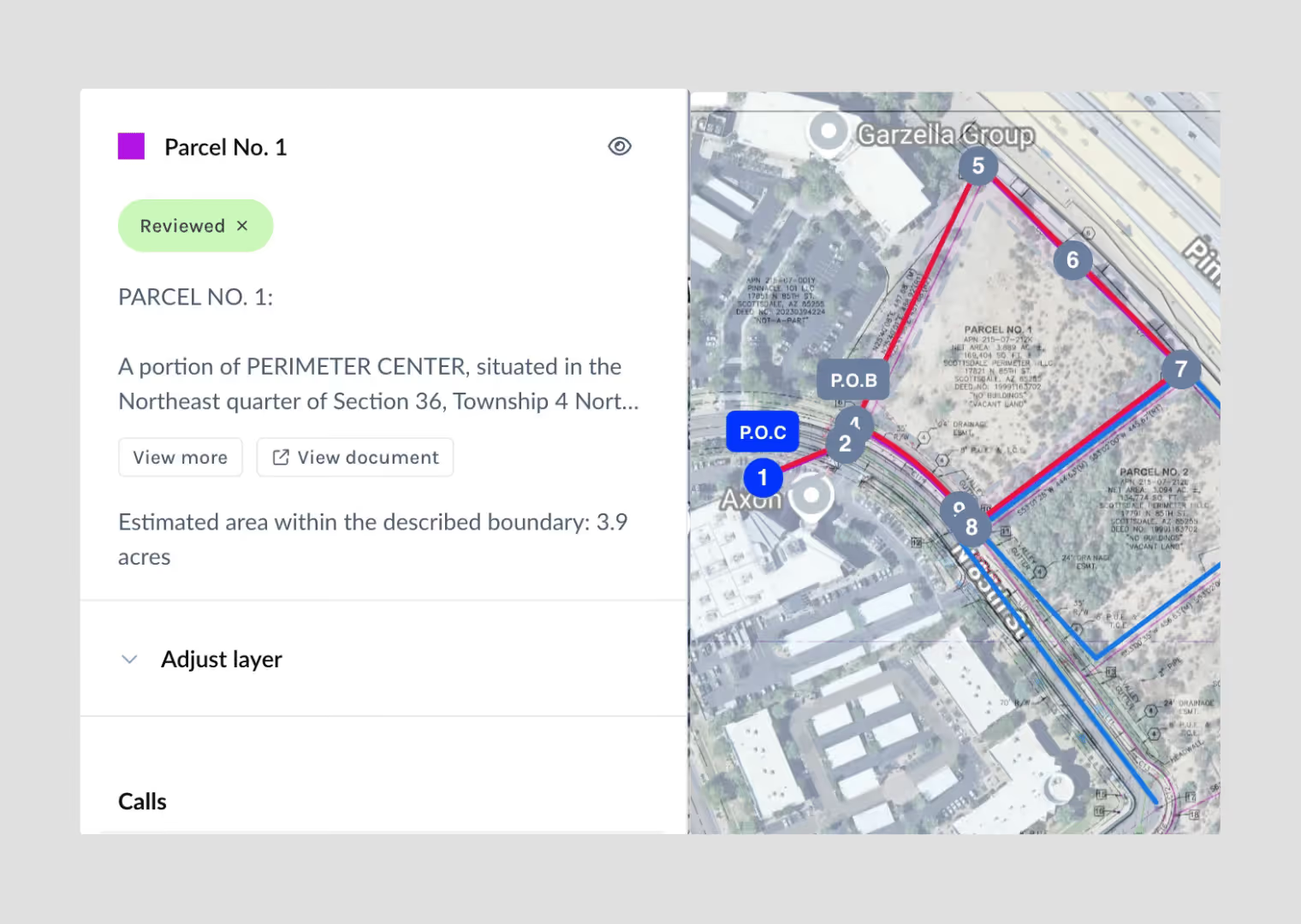
✓ Plot legal descriptions: Spot potential issues faster by visualizing metes and bounds or PLSS descriptions, along with easements and restrictions, to confirm what actually affects the parcel.
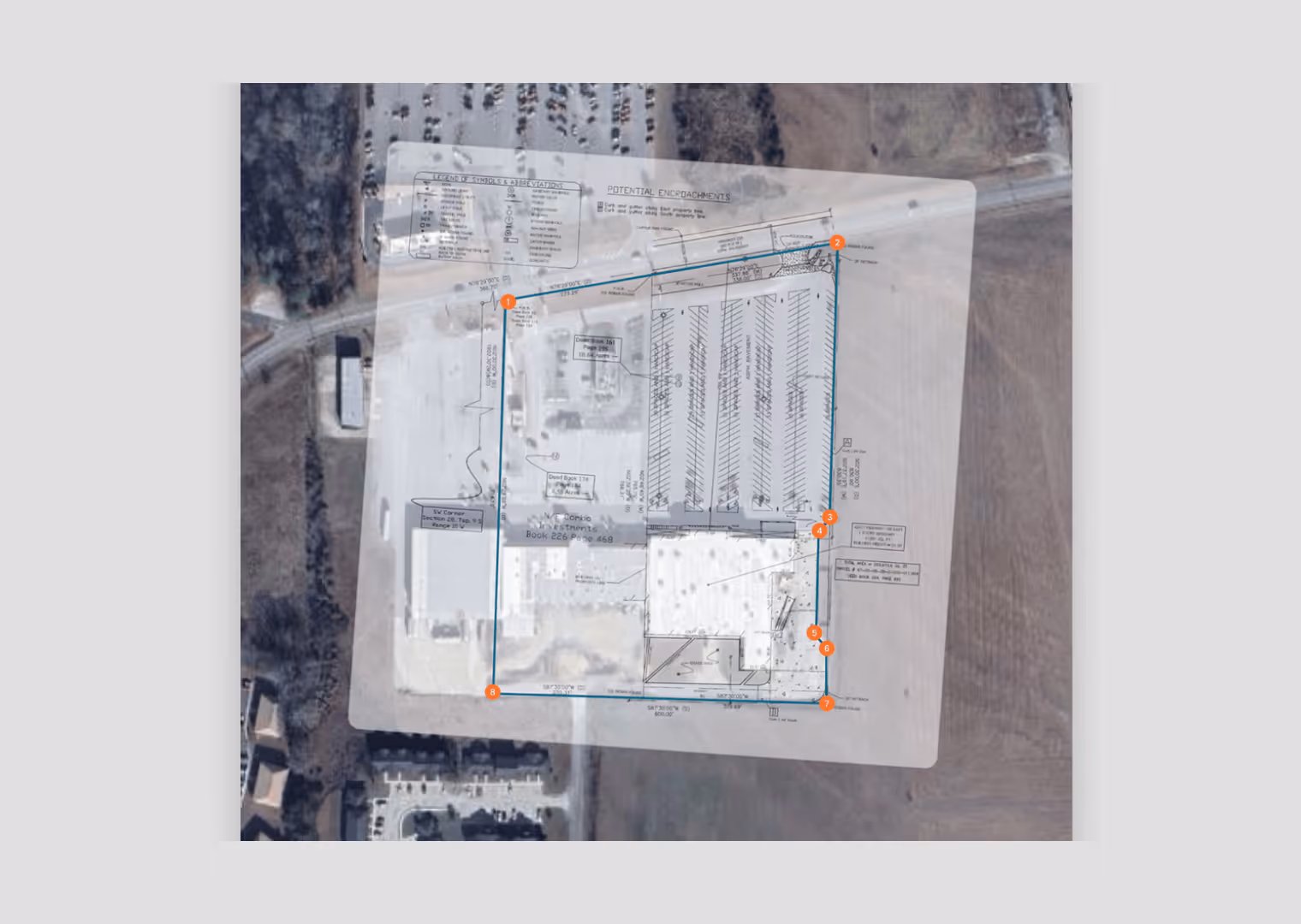
✓ Overlay surveys and plat maps: Identify risk earlier by layering documents on top of parcel data and map layers to validate boundaries, see the surrounding area, and spot issues like encroachments.
✓ Export clear visuals: Give clients faster, clearer answers by sharing maps in memos, reports, or on screen instead of relying on dense text alone.
How Property Visualizer Fits Into Real Estate Workflows
Property Visualizer is designed to fit the way real estate attorneys actually work, not add extra steps. It helps at every stage of the review process:
1. Early Orientation
Property Visualizer lets you search by APN/Tax ID or address to locate the site immediately, then see parcel boundaries and ownership records. You can also use maps and satellite imagery to explore nearby features such as highways, schools, or gas stations that could affect the matter. That early view makes it easier to scope the work, set client expectations, and flag potential issues without waiting weeks for the Title Commitment or survey to arrive.
2. Title Commitment and Survey Review
Once the Title Commitment is issued (and later when the survey comes back) the focus shifts to confirming exactly what affects the parcel. Commitments often pull in restrictions from much larger tracts, leaving attorneys and paralegals to sort out which exceptions really apply.
With Property Visualizer, you can plot metes & bounds or PLSS descriptions from uploaded documents, check the outline against expected acreage, and overlay surveys and plat maps for comparison. Exceptions such as easements or covenants can be visualized to see whether they truly affect the site. By the time the survey arrives, you already have a visual baseline to work from.
3. Disputes and Development Advisory Work
Beyond title and survey review, attorneys often need to understand how property details affect the client’s position. This could involve advising on restrictions for a development project or working through a boundary dispute.
Property Visualizer supports this work. For development, you can overlay proposed building footprints on a survey to spot conflicts with easements or restrictions. For disputes, you can compare a satellite view of what exists with overlays showing what should be there to clarify boundaries.
Why It Matters
Property Visualizer helps real estate professionals move faster, communicate more clearly, and advise with greater precision.
Instead of waiting weeks for a survey, you can form an early view of the site in minutes. Instead of juggling multiple tools, you can work in one place. And instead of explaining issues in words alone, you can show clients exactly what’s happening on the land.
Watch this short demo to see how Property Visualizer helps attorneys get the lay of the land and create clear visuals as part of the title and survey workflow.
Orbital
Book a demo for your firm
.svg)

.avif)